![]() This is an enhanced Google map, which allows users to find out more about each of the Liverpool Irish Famine Trail sites. To learn more, tap on a crest and on the flag that pops up. This will take you to a map of the site as well as information on it. Use the tabs to navigate through to find a personal story connected with the site; the site’s connection to the Liverpool Irish Famine and a gallery of images.
This is an enhanced Google map, which allows users to find out more about each of the Liverpool Irish Famine Trail sites. To learn more, tap on a crest and on the flag that pops up. This will take you to a map of the site as well as information on it. Use the tabs to navigate through to find a personal story connected with the site; the site’s connection to the Liverpool Irish Famine and a gallery of images.
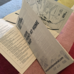 (Left) Our tri-fold map gives short details to all our Trail sites and links to our enhanced Google map. so it’s a useful thing to keep in yoru top pocket! Black-and-white (save the planet!) and colourised versions (use on screen) will be available for you to use as you wish.
There are three catagories of site:
- The Liverpool Irish Famine Memorial
- Liverpool Irish Famine plaque sites
- Sites of Irish influence.
Though we recommend visiting all of the Liverpool Irish Famine Trail sites, trying to do all 15 in a day may be a bit hard, depending on your speed, weather, traffic and travel options. These categories may help you to split the Trail in to more manageable trail lengths. The 15 sites are:
1: The Liverpool Famine Memorial
St Luke’s Church, Leece Street, Liverpool L1 2TR
Coordinates 53.40196 – 2.97482
2: Pleasant Street School
Pleasant Street, L3 5TT (original school)/L3 5TS (new school)
Coordinates 53.40480981264833, -2.9731960258411685
3: The Brownlow Hill Workhouse
Hart Building, Mount Pleasant, L69 7ZX
Coordinates 53.40556819487453, -2.9667444702188464
4: The Paupers’ Graveyard
Mulberry Street, L69 7SH (plaque)/ L7 7EF (original cemetery)
Coordinates L69 7SH 53.4017950830834,
-2.9671092599499955
5: Agnes Jones House
1A Catharine Street, L8 7JZ
Coordinates 53.4000188937363,-2.9674296883117526
6: Kitty Wilkinson’s grave
St James’s Gardens at Liverpool Anglican Cathedral, L1 7AZ
Coordinates 53.39735,-2.97211
7: St Patrick’s Chapel
Park Place, Park Road, L8 5RA
Coordinates 53.39223128803399, -2.971767215300476
8: James Larkin’s birthplace
The Globe, 44-46 Park Road, L8 6SH
Coordinates 53.389830256572886, -2.97055984460683
9: The Pilotage Building
Canning Pier, L3 1BY
Coordinates 53.40230261972989, -2.995353873442184
10: Relief Station
Fenwick Street, L2 0NZ
Coordinates 53.40594741449407, -2.9914153153000633
11: Father Nugent’s statue
St John’s Gardens (facing Old Haymarket
and Tunnel entrance), L1 1JJ
Coordinates 53.408639270899066, -2.9817393022778247
12: Lace Street, L3 2BP
The plaque is currently concealed from view
Coordinates 53.41158930486327, -2.9845873140194024
13: Dandy Pat memorial
St Anthony’s Church, Scotland Road, L5 5BD
Coordinates 53.42236596190368, -2.98146103064052
14: Clarence Dock
10 Regent Rd, Liverpool L3 7DS
Coordinates 53.418957, -3.000072
15: Price Street
Birkenhead, CH41 6DQ
Coordinates 53.393644767651296, -3.018889895021838